
Fitxer:Virginia1781 SpencersAndGreenSpring.jpg
Mida d'aquesta previsualització: 587 × 599 píxels. Altres resolucions: 235 × 240 píxels | 470 × 480 píxels | 752 × 768 píxels | 1.003 × 1.024 píxels | 1.520 × 1.552 píxels.
Fitxer original (1.520 × 1.552 píxels, mida del fitxer: 986 Ko, tipus MIME: image/jpeg)
| Aquest fitxer i la informació mostrada a continuació provenen del dipòsit multimèdia lliure Wikimedia Commons. |
Resum
| Descripció |
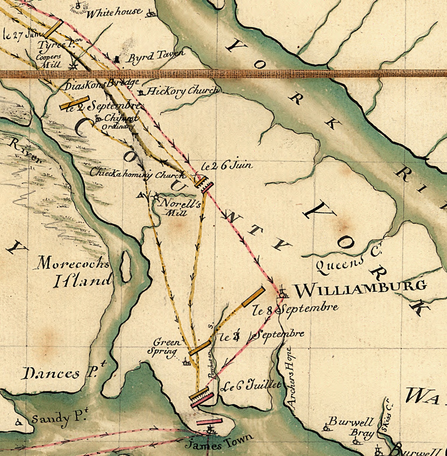
English: Detail of a military prepared by an assistant to the Marquis de Lafayette in 1781. The full map shows the movements of Lafayette and Cornwallis in Virginia during the 1781 Yorktown campaign. This detail shows a portion of the Virginia Peninsula running west and north from Williamsburg; this area was the scene of two battles between the two forces: Battle of Spencer's Ordinary (location labeled "le 26 Juin") and Battle of Green Spring (location labeled "le 6 Juille"). |
||
| Data | |||
| Font |
|
||
| Autor | Michel du Chesnoy (1746-1804) |

Llicència
|
Aquest material està en domini públic als Estats Units i als altres països on el dret d'autor s'estén per 100 anys (o menys) després de la mort de l'autor. | |
| Aquest fitxer està identificat com a lliure de restriccions conegudes sota la llei de drets d'autor, inclosos els drets veïns. | |
Historial del fitxer
Cliqueu una data/hora per veure el fitxer tal com era aleshores.
| Data/hora | Miniatura | Dimensions | Usuari/a | Comentari | |
|---|---|---|---|---|---|
| actual | 14:25, 6 ago 2010 | | 1.520 × 1.552 (986 Ko) | Magicpiano | {{Information |Description={{en|Detail of a military prepared by an assistant to the Marquis de Lafayette in 1781. The full map shows the movements of Lafayette and Cornwallis in Virginia during the 1781 Yorktown campaign. This detail shows a portion of |
Ús del fitxer
La pàgina següent utilitza aquest fitxer:
Ús global del fitxer
Utilització d'aquest fitxer en altres wikis:
- Utilització a azb.wikipedia.org
- Utilització a en.wikipedia.org
- Utilització a ja.wikipedia.org
- Utilització a www.wikidata.org