
Fitxer:Guinea-Bissau Topography.png
Mida d'aquesta previsualització: 800 × 540 píxels. Altres resolucions: 320 × 216 píxels | 640 × 432 píxels | 1.024 × 692 píxels | 1.233 × 833 píxels.
Fitxer original (1.233 × 833 píxels, mida del fitxer: 1,35 Mo, tipus MIME: image/png)
| Aquest fitxer i la informació mostrada a continuació provenen del dipòsit multimèdia lliure Wikimedia Commons. |
Resum
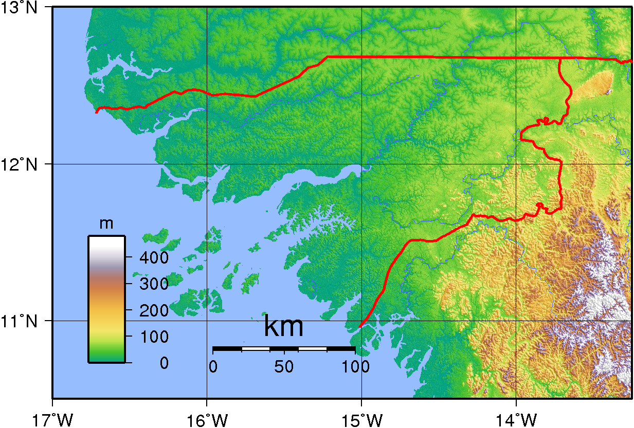
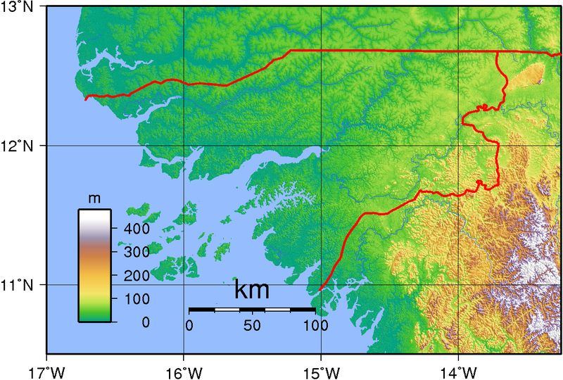
| Descripció | Topographic map of Guinea-Bissau. Created with GMT from SRTM data |
| Data | |
| Font | Treball propi |
| Autor | Sadalmelik |
Llicència
| S'ha alliberat aquesta obra al domini públic pel seu autor I, Sadalmelik. Això s'aplica a tot el món. En alguns països això pot no ser legalment possible, en tal cas: I, Sadalmelik concedeix a tothom el dret d'usar aquesta obra per a qualsevol propòsit, sense cap condició llevat d'aquelles requerides per la llei. |
Historial del fitxer
Cliqueu una data/hora per veure el fitxer tal com era aleshores.
| Data/hora | Miniatura | Dimensions | Usuari/a | Comentari | |
|---|---|---|---|---|---|
| actual | 22:03, 29 juny 2007 | | 1.233 × 833 (1,35 Mo) | Sadalmelik | {{Information |Description=Topographic map of Guinea-Bissau. Created with GMT from SRTM data |Source=self-made |Date=June 29, 2007 |Author= Sadalmelik }} Category:Maps of Guinea-Bissau Category:Topographic maps of Africa |
Ús del fitxer
La pàgina següent utilitza aquest fitxer:
Ús global del fitxer
Utilització d'aquest fitxer en altres wikis:
- Utilització a en.wikipedia.org
- Utilització a es.wikipedia.org
- Utilització a fa.wikipedia.org
- Utilització a fi.wikipedia.org
- Utilització a ha.wikipedia.org
- Utilització a hu.wikipedia.org
- Utilització a ig.wikipedia.org
- Utilització a it.wikipedia.org
- Utilització a mdf.wikipedia.org
- Utilització a smn.wikipedia.org
- Utilització a uk.wikipedia.org
- Utilització a vep.wikipedia.org