
Fitxer:Tsavo national park map en.png
Mida d'aquesta previsualització: 620 × 600 píxels. Altres resolucions: 248 × 240 píxels | 496 × 480 píxels | 1.000 × 967 píxels.
Fitxer original (1.000 × 967 píxels, mida del fitxer: 1,15 Mo, tipus MIME: image/png)
| Aquest fitxer i la informació mostrada a continuació provenen del dipòsit multimèdia lliure Wikimedia Commons. |
| Descripció | |
| Data | |
| Font | own work, background created with Google Maps-For-Free SRTM3 Webserver, small map created with Blank_Map-Africa.svg |
| Autor | Lencer |

|
This map has been made or improved in the German Kartenwerkstatt (Map Lab). You can propose maps to improve as well.
|
Aquest fitxer està subjecte a la llicència de Creative Commons Reconeixement i Compartir Igual 3.0 No adaptada.
- Sou lliure de:
- compartir – copiar, distribuir i comunicar públicament l'obra
- adaptar – fer-ne obres derivades
- Amb les condicions següents:
- reconeixement – Heu de donar la informació adequada sobre l'autor, proporcionar un enllaç a la llicència i indicar si s'han realitzat canvis. Podeu fer-ho amb qualsevol mitjà raonable, però de cap manera no suggereixi que l'autor us dóna suport o aprova l'ús que en feu.
- compartir igual – Si modifiqueu, transformeu, o generareu amb el material, haureu de distribuir les vostres contribucions sota una llicència similar o una de compatible com l'original
Historial del fitxer
Cliqueu una data/hora per veure el fitxer tal com era aleshores.
| Data/hora | Miniatura | Dimensions | Usuari/a | Comentari | |
|---|---|---|---|---|---|
| actual | 16:33, 13 gen 2019 | | 1.000 × 967 (1,15 Mo) | Lencer | fix scale |
| 19:14, 20 set 2007 |  | 1.000 × 963 (1,12 Mo) | Lencer | ||
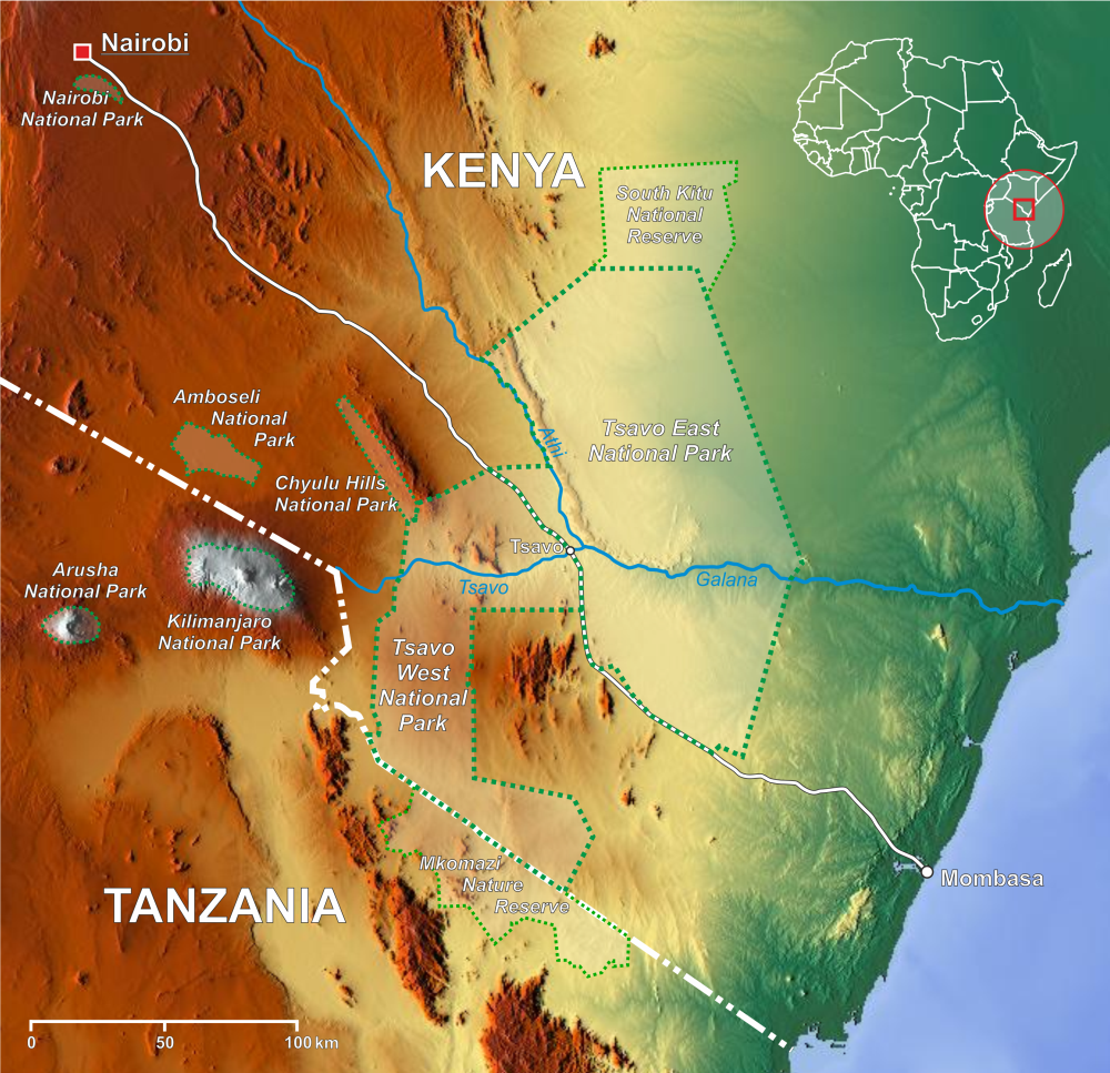
| 18:58, 20 set 2007 |  | 1.000 × 966 (1,12 Mo) | Lencer | {{Information| |Description=Map of Tsavo East National Park and Tsavo West National Park |Source=own work, background created with [http://www.maps-for-free.com/ Google Maps-For-Free] SRTM |
Ús del fitxer
La pàgina següent utilitza aquest fitxer:
Ús global del fitxer
Utilització d'aquest fitxer en altres wikis:
- Utilització a ar.wikipedia.org
- Utilització a bg.wikipedia.org
- Utilització a cs.wikipedia.org
- Utilització a da.wikipedia.org
- Utilització a de.wikipedia.org
- Utilització a en.wikipedia.org
- Utilització a eo.wikipedia.org
- Utilització a es.wikipedia.org
- Utilització a eu.wikipedia.org
- Utilització a fa.wikipedia.org
- Utilització a fi.wikipedia.org
- Utilització a fr.wikipedia.org
- Utilització a fr.wikivoyage.org
- Utilització a hi.wikipedia.org
Vegeu més usos globals d'aquest fitxer.