
Fitxer:Turkey relief location map.jpg

Mida d'aquesta previsualització: 800 × 343 píxels. Altres resolucions: 320 × 137 píxels | 640 × 274 píxels | 1.579 × 677 píxels.
Fitxer original (1.579 × 677 píxels, mida del fitxer: 749 Ko, tipus MIME: image/jpeg)
| Aquest fitxer i la informació mostrada a continuació provenen del dipòsit multimèdia lliure Wikimedia Commons. |
| Descripció |
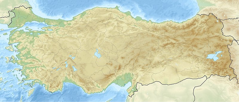
Deutsch: Positionskarte der Türkei Quadratische Plattkarte, N-S-Streckung 120 %. Geographische Begrenzung der Karte: * N: 42.5° N * S: 35.5° N * W: 25.4° O * O: 45.0° O English: Location map of Turkey Equirectangular projection, N/S stretching 120 %. Geographic limits of the map: * N: 42.5° N * S: 35.5° N * W: 25.4° E * E: 45.0° E |
| Data | (UTC) |
| Font | |
| Autor |
|
| Altres versions |
|

| Això és una imatge retocada, cosa que vol dir que ha estat alterada digitalment de la seva versió original. Modificacions: {{{1}}}. L'original es pot veure a: Turkey location map.svg:
|
Jo, el titular dels drets d'autor d'aquest treball, el public sota les següents llicències:
Aquest fitxer està subjecte a la llicència de Creative Commons Reconeixement i Compartir Igual 3.0 No adaptada.
- Sou lliure de:
- compartir – copiar, distribuir i comunicar públicament l'obra
- adaptar – fer-ne obres derivades
- Amb les condicions següents:
- reconeixement – Heu de donar la informació adequada sobre l'autor, proporcionar un enllaç a la llicència i indicar si s'han realitzat canvis. Podeu fer-ho amb qualsevol mitjà raonable, però de cap manera no suggereixi que l'autor us dóna suport o aprova l'ús que en feu.
- compartir igual – Si modifiqueu, transformeu, o generareu amb el material, haureu de distribuir les vostres contribucions sota una llicència similar o una de compatible com l'original

|
S'autoritza la còpia, la distribució i la modificació d'aquest document sota els termes de la llicència de documentació lliure GNU versió 1.2 o qualsevol altra versió posterior que publiqui la Free Software Foundation; sense seccions invariants, ni textos de portada, ni textos de contraportada. S'inclou una còpia d'aquesta llicència en la secció titulada GNU Free Documentation License. |
Podeu seleccionar la llicència que vulgueu.
Registre original de càrregues
This image is a derivative work of the following images:
- File:Turkey_location_map.svg licensed with Cc-by-sa-3.0, GFDL
- 2008-07-19T19:49:14Z NordNordWest 1579x677 (999148 Bytes) {{Information |Description= {{de|Positionskarte der [[:de:Türkei|Türkei]]}} Quadratische Plattkarte, N-S-Streckung 120 %. Geographische Begrenzung der Karte: * N: 42.5° N * S: 35.5° N * W: 25.4° O * O: 45.0° O {{en|Loca
Uploaded with derivativeFX
| Anotacions | Aquesta imatge té anotacions: Vegeu-les a Commons |
Historial del fitxer
Cliqueu una data/hora per veure el fitxer tal com era aleshores.
| Data/hora | Miniatura | Dimensions | Usuari/a | Comentari | |
|---|---|---|---|---|---|
| actual | 14:42, 28 juny 2010 | | 1.579 × 677 (749 Ko) | Uwe Dedering | {{Information |Description={{de|Positionskarte der Türkei}} Quadratische Plattkarte, N-S-Streckung 120 %. Geographische Begrenzung der Karte: * N: 42.5° N * S: 35.5° N * W: 25.4° O * O: 45.0° O {{en|Location map of [[:en:Turkey|Turkey |
Ús del fitxer
Les 13 pàgines següents utilitzen aquest fitxer:
Ús global del fitxer
Utilització d'aquest fitxer en altres wikis:
- Utilització a als.wikipedia.org
- Utilització a am.wikipedia.org
- Utilització a ar.wikipedia.org
- قالب:خريطة مواقع تركيا
- فالق شمال الأناضول
- مستخدم:عبد المؤمن/مسودات/خرائط/تركيا
- مستخدم:"Yahia"/ملعب
- نهر مراد
- وحدة:Location map/data/Turkey
- وحدة:Location map/data/Turkey/شرح
- نفق الاستقلال 15 يوليو
- أطلس جت الرحلة 4203
- أولودنيز
- زلزال معمورة العزيز 2020
- قونور ألب
- الاشتباكات الحدودية التركية السورية خلال الحرب الأهلية السورية
- زلزال قهرمان مرعش 2023
- زلزال أرزنجان 1939
- زلزال أضنة وجيحان 1998
- زلزال أميك 1872
- Utilització a arz.wikipedia.org
- Utilització a ast.wikipedia.org
- Utilització a av.wikipedia.org
- Utilització a azb.wikipedia.org
- Utilització a az.wikipedia.org
Vegeu més usos globals d'aquest fitxer.